
Photo by Good Days Digital on Unsplash
Drones and Their Many Applications
Drone usage has evolved from a niche hobby to a vital tool in various industries, revolutionizing the way we capture data from the sky. Among its many applications, drone mapping stands out as a transformative method for collecting and analyzing geographical data, offering unprecedented precision and flexibility.
What is Drone Mapping?
Drone mapping refers to the process of using unmanned aerial vehicles (UAVs), or drones, equipped with various sensors (usually a camera of some sort) to capture aerial photographs and gather data over areas of interest. These images and data are then processed using specialized software like OpenDroneMap, Pix4D, DroneDeploy, or others to create detailed maps and 3D models of the surveyed area.
The core science behind drone mapping is photogrammetry, the science of making measurements from photographs. Drones capture a series of overlapping images of the ground, which photogrammetry software stitches together to create comprehensive maps and models. These outputs are often in the form of 2D “orthophotos” or 3D “point clouds.”
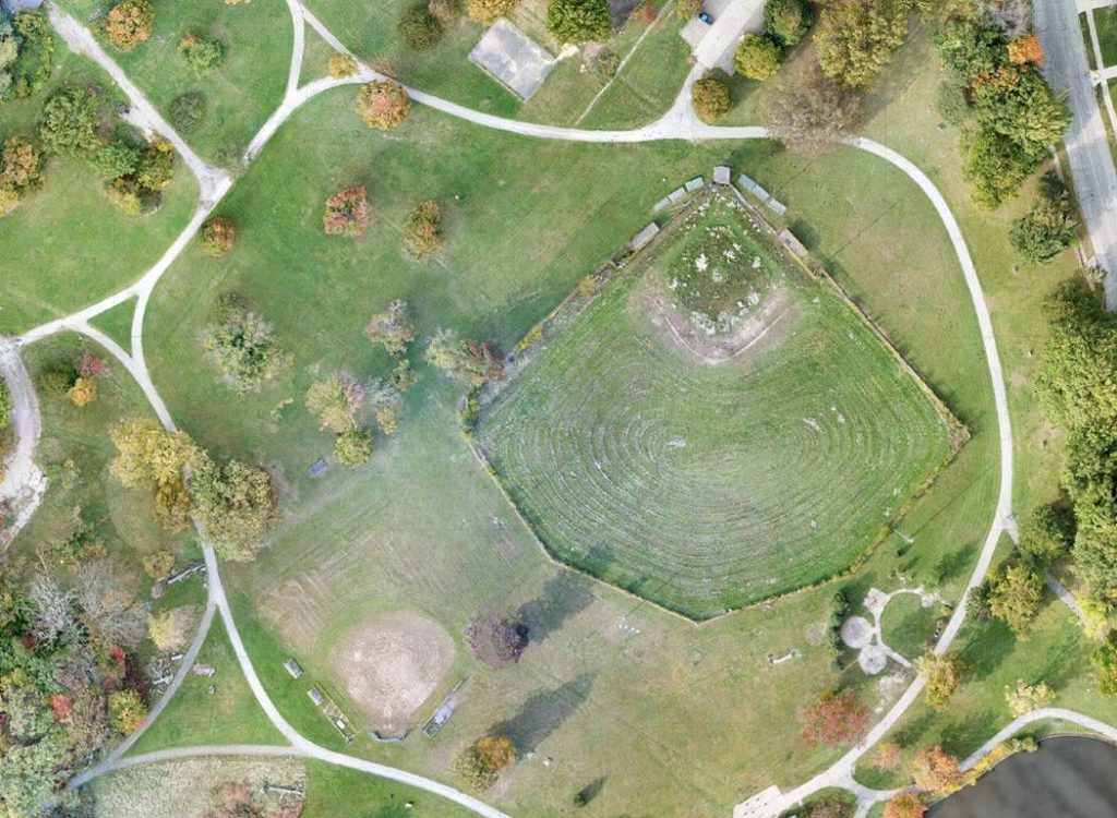
Orthophoto Generated From Drone Imagery (Source: UAVistas)
Orthophotos and Point Clouds
Orthophotos, also called orthomosaics, are the 2D outputs of most photogrammetry software and consist of the stitched-together images collected by a drone. They are often used to help take length and area measurements of a large area or get an accurate, up-to-date, detailed view of a large area. They can also be used as accurate base maps for other applications.
The terms orthophoto, orthomosaic, and orthophotomap are similar but slightly different when you dig into their precise meanings. This is a bit out of the scope of this article but the distinction between a DTM (Digital Terrain Map) and DSM (Digital Surface Map) is important to make. A DTM maps the terrain, excluding the things that sit on top of the ground, like buildings and trees. When constructing a DTM, some software will attempt to omit the structures on the ground from the viewing model altogether. A DSM is a model that includes the structures on the surface, keeping their dimensions such as height and shape and recreating them as accurately as possible.
Point clouds are 3D representations of an area generated using thousands, hundreds of thousands, or even millions of points. Depending on the software, the shape and size of the points can be changed, as well as their density. Point clouds give a different perspective of an area and be used for viewing the sides of objects and volume measurements. They can even be used to create locations in a videogame (although I have not tried this myself yet).
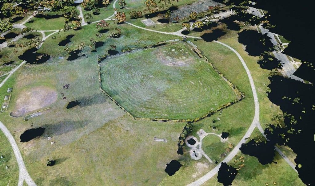
3D Point Cloud of the same area as above (Source: UAVistas)
Applications of Drone Mapping
The versatility of drone mapping allows it to serve numerous industries and purposes. Here are some of the key areas where it is making a significant impact:
- Agriculture: Farmers use drone mapping to monitor crop health, evaluate soil conditions, and manage resources more efficiently. By analyzing maps, they can identify areas that require attention, optimize pesticide application, and improve yield predictions.
- Construction and Real Estate: In construction, drone mapping is used for site planning, monitoring progress, and maintaining up-to-date records of projects. Real estate professionals leverage aerial maps to showcase properties and give potential buyers a comprehensive view of the area.
- Environmental Conservation: Conservationists employ drone mapping to monitor ecosystems, track wildlife, and assess the impact of climate change on natural habitats. This helps in making informed decisions for conservation strategies and in documenting changes over time.
- Disaster Response and Management: Following natural disasters, drone mapping provides quick and accurate assessments of the affected areas. It helps identify the extent of damage, plan rescue operations, and coordinate recovery efforts. Drone mapping combined with other fields of science such as hydrology can also be used to understand disaster risks and avoid the worst outcomes.
- Urban Planning and Development: City planners use drone mapping for infrastructure development, zoning, and land use planning. This technology aids in visualizing future projects and in making decisions that shape the growth of urban areas.
Quick note: I use drones in the environmental conservation arena, so that use case is close to my heart. I may write an article or two down the line talking specifically about this area of drone use.
Advantages of Drone Mapping
Drone mapping offers several advantages over traditional surveying methods and even plane and helicopter surveys, such as:
- Efficiency: Drones cover large areas quickly, reducing the time and labor required for field surveys.
- Accuracy: High-resolution imagery and advanced processing software result in precise maps and models.
- Accessibility: Drones can reach areas that are difficult, dangerous, or impossible to access on foot or with manned aircraft.
- Cost-effectiveness: Compared to traditional aerial surveying methods, drone mapping is often more affordable and requires less equipment.
Challenges and Considerations
Despite its benefits, drone mapping has challenges, including regulatory restrictions, privacy concerns, and the need for specialized training to operate drones and analyze data. As it stands, mapping is a drone specialty and is not yet a common skill set among drone pilots.
As the technology continues to evolve, addressing these issues will be crucial for expanding its applications and maximizing its potential.
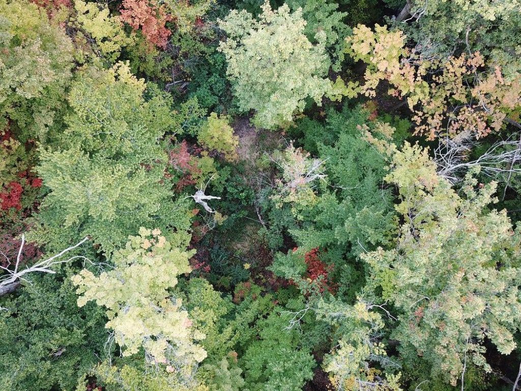
Drone Image of Trees in Early Fall (Source: UAVistas)
Conclusion
Drone mapping is a powerful tool transforming industries by providing detailed, accurate, and accessible geographical data. From agriculture to urban planning, it offers a new perspective on our world, enabling professionals to make informed decisions based on comprehensive aerial insights. As technology advances and regulations adapt, the future of drone mapping promises even greater possibilities for exploration, analysis, and innovation.
Leave any questions you have in the comments, and I’ll try to address them in one of my articles.
Thank you for reading!
Author: India T. Johnson